
Tracing the Past at Tapoa Magazine Bay

Magazine Bay, 2024.
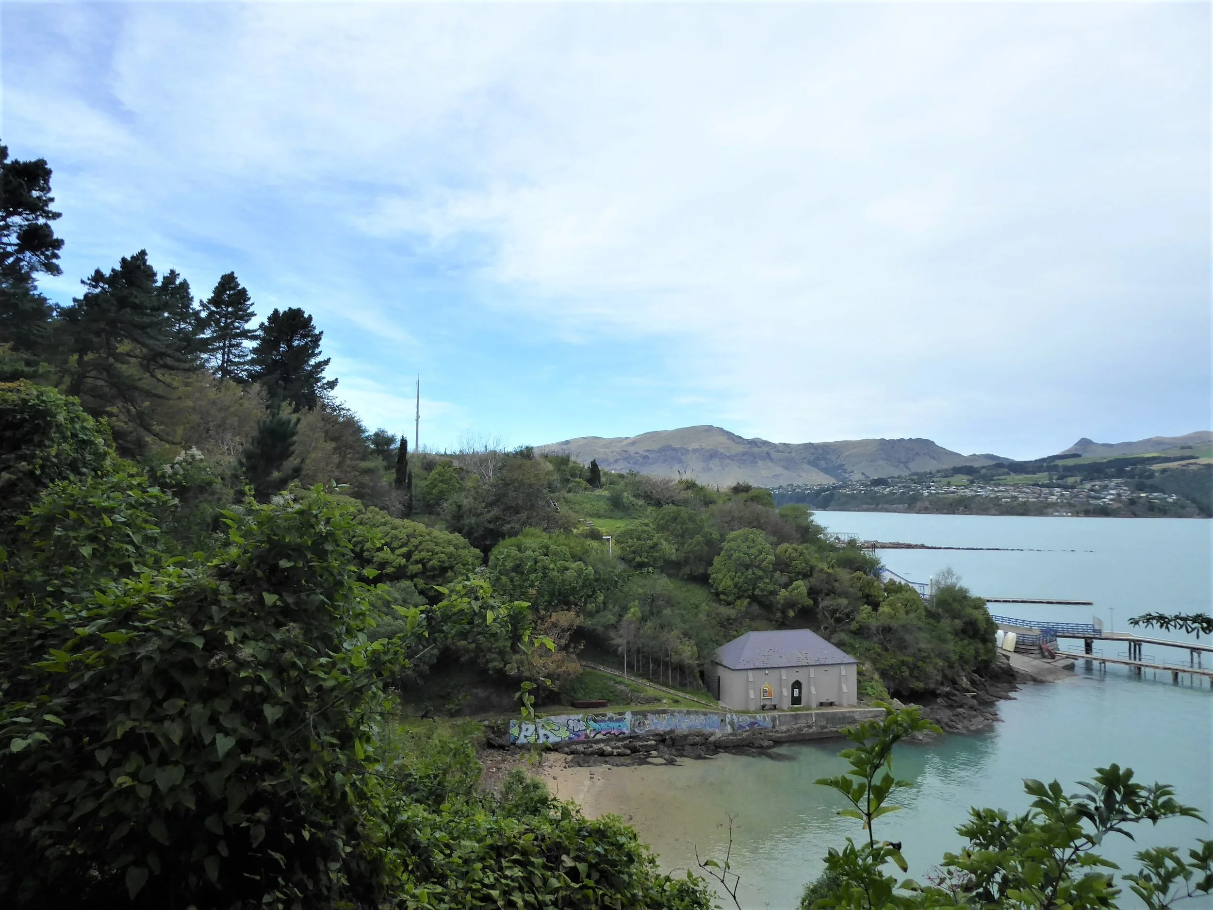
At first glance, Tapoa Magazine Bay seems like a quiet place … another swimming spot along the Whakaraupō Lyttelton Harbour edge.
But tucked into the volcanic cradle of the harbour, Tapoa, meaning ‘wind swirling around’, has long been a place of movement and connection. It was once a natural access route between Ōhinehou Lyttelton and Rāpaki. And from 1877 part of a scenic public domain shaped by pathways, terracing and stone walls that can still be traced today.
By the late 1800s, fear of a Russian invasion drove a wave of coastal fortifications across Aotearoa. At Tapoa, a rare Vauban-style magazine was constructed - one of the only examples of its kind in the county - followed by the Erskine Point gun emplacement, whose concrete pads and parapets still frame views across the harbour today. These structures were part of a wider strategic defence network that included Awaroa Godley Head, Battery Point and Rīpapa Island Fort Jervois.
But Tapoa is more than its built elements. The landscape is just as significant. The site is part of a historic walking track from Park Terrace to Ōtūherekio Pony Point, popular since the late 19th century when the area was promoted as a ‘pleasure resort’. Remnant stone walls, terracing and paths offer clues to its former life as a public domain, while mature exotic trees stand as living connections to early plantings.
Tapoa’s cultural and spiritual values are significant. For Māori, the bay remains part of a traditional route between Ōhinehou and Rāpaki and the ridge lines above carry important ancestral place names and associations.
I worked alongside heritage architects Chessa Stevens and Alex Vakhrousheva, and the Christchurch City Council heritage team, to understand these layers … both visible and those less tangible … to develop conservation policies that could help guide the site’s future.
That meant looking at not only the magazine and gun emplacement but the pathways, plantings, views and stories that give this place meaning. The conservation plan offers clear direction for protecting what’s significant, while allowing the site to keep evolving, just as it always has.
Our Conservation Management Plan provides a clear framework to guide future decisions and work on the site. By identifying what’s most significant - and what’s at risk of being lost - the plan ensures that any changes support the long term protection, understanding and visibility of the site’s layered heritage.
It’s work that reminds us why context matters. Tapoa Magazine Bay is not just a site with heritage features, but a landscape of people’s experience … shaped over time by recreation, defence, leisure, and change.
Magazine Bay, 2024.

Subdivision plan of Lyttelton sections, showing Tapoa Magazine Bay and the public domain lower left. Source: LINZ 1885.

Sandy Bay, immediately north of Magazine Bay c1890. Trees in the Lyttelton Domain can be seen at the top of the photograph. Source: Archives NZ/Ecan.

Magazine Bay, 1925. Source: Discovery Wall.

Magazine Bay, 2024.
Keen to know more … explore these projects!